|
Number
|
Description
|
|
|
 |
B/W photo from 19th century
|
|
|
|
From bridge on Tcherniya River
|
|
| |
|
View of the ruin of Kalimata fortress from
below in 1992 with the ruin of the monastery - compare with the photos of the
same building in 1998.
|
|
| |
|
View from path outside the fortress
|
|
|
|
Inside castle by entrance tower
|
|
|
|
Telephoto photo of the remaining fortress
towers
|
|
|
|
View up from monastery at base of cliff
|
|
| |
|
Another view of the monastery and tower
above.
|
|
| |
|
View of the ruined tower of Kalimata fortress
on bluff above the Chernia river as it flows into Sevastopol harbor - this
shows why it was such a critical place for the rulers of Feodora to secure for
them a harbor.
|
|
| |
|
View of remaining ruined tower in Kalimata
fortress
|
|
| |
|
View of Kalimata fortress ruin from window of
train crossing the ridge enroute to Sevastopol.
|
|
| |
|
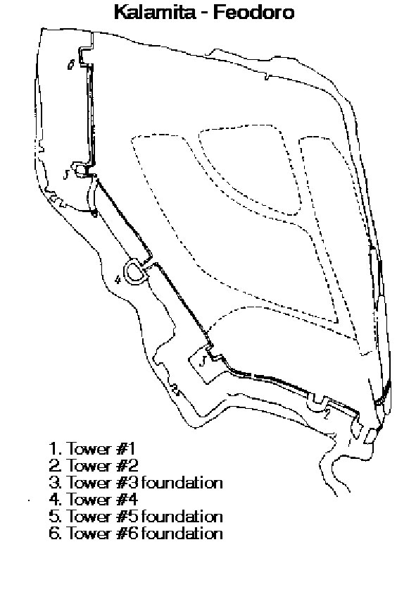
Sketch map of the Kalimata fortress showing
the original layout of the towers and walls, now mostly disappeared
|
|
| |
|
|
|