
|
SERINDIA MAPS - STEIN |
||
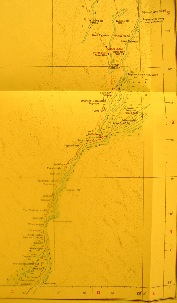
These are photos made from the original maps in Volume V of Serindia, Aurel Stein's report on his Second Expedition into Chinese Turkestan. |
||
 |
||
Here we have the eastern part of map sheet # 30 - Kara Dong. It shows the Keriya River flowing north from the south edge along the east side. The entire western part was unsurveyed as Stein only did what he could while following the river bed south. The Kara Dong ruin is at 81 degrees 55' E - 38 Degrees 32' N. There is no map sheet directly north of this one. Stein was searching for the dry river bed moving south from Shahyar and his route shows on map sheet 36, NE of this one. |