
|
SERINDIA MAPS - STEIN |
||
These are photos made from the original maps in Volume V of Serindia, Aurel Stein's report on his Second Expedition into Chinese Turkestan. |
||
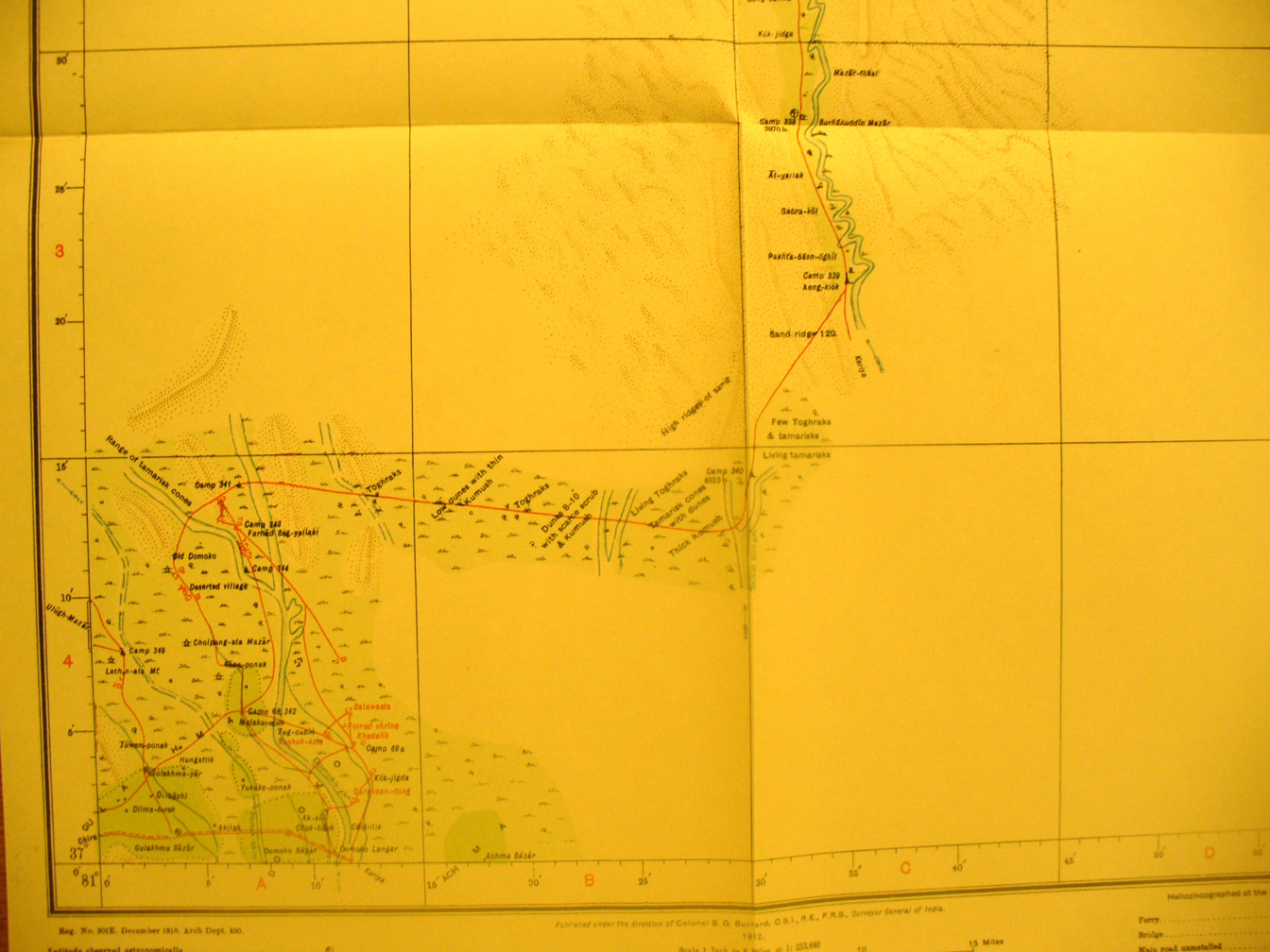 |
||
This is the south west corner of map sheet # 31 - Domoko - Traveling up stream on the Keriya River bed he shifted westward to return to the ruins at Domoko. These include the ruin at Khadalik (81 degrees 11' E - 37 degrees 5' N). The road to Keriya town is in the south west corner also. Old Domoko is on the Domoko River, which disappears into the desert. There is a gap in the survey of the Keriya River at this point south of where Stein left it. |