
|
 |
||
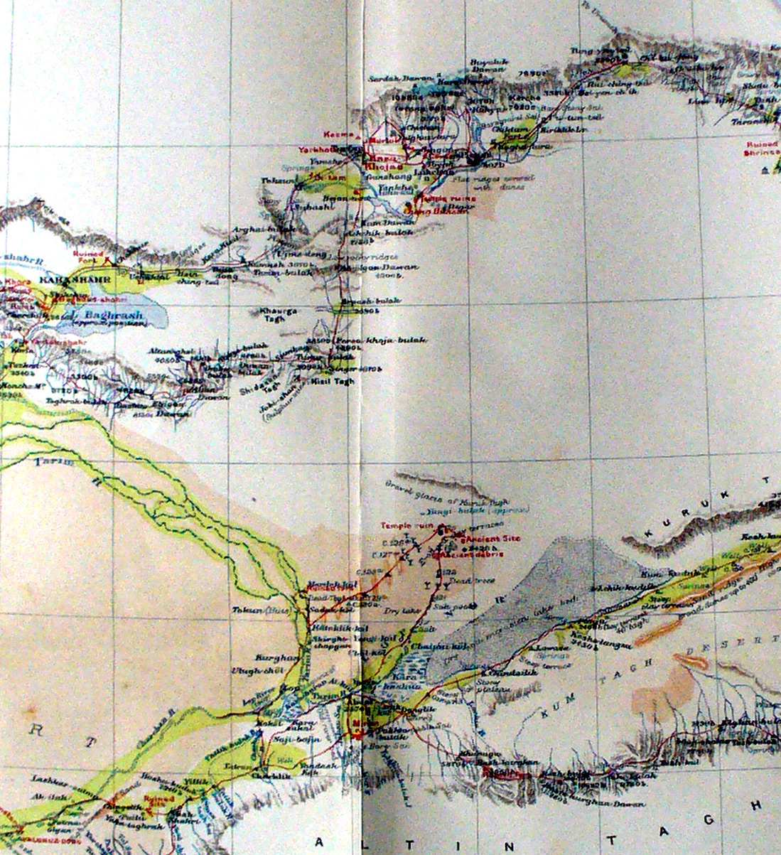
Detail from Stein's map on Chinese Turkestan showing the area around the Lop salt sea where the Tarim river from the north west and the Charchan river from the south west merge and disappear into the sands in marsh delta. Charckilk is in lower left center and Miran is in lower center with Lou-lan above it in the desert. During the second expedition Stein moved from Lou-lan back to Miran and then eastward as his track shows along the southern 'shore' of the Lop salt sea. But in the Third Expedition he found the ancient caravan route from Lou-lan directly across the salt to reach the other route south of the Kuruk Tagh. The northern edge of the map shows the main route from the east along the mountains to Karashahr which Stein followed on his way back. |
||