
|
 |
||
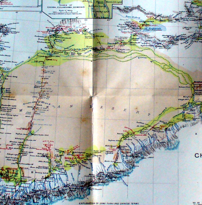
The central section of Stein's map of the Takla Makan shows his routes east from Keriya to Charchan and west from Hami to Kuchar and his route south from Kuchar across the desert back to Keriya. - The map also shows the Charchan River flowing east out of the foothills of the Kun-lun on the south side of the desert meeting the Tarim River flowing east from the Pamirs and T'ien-shan on the north side of the desert. They eventually dry up at the Lop-nor salt flat. |
||