
|
 |
||
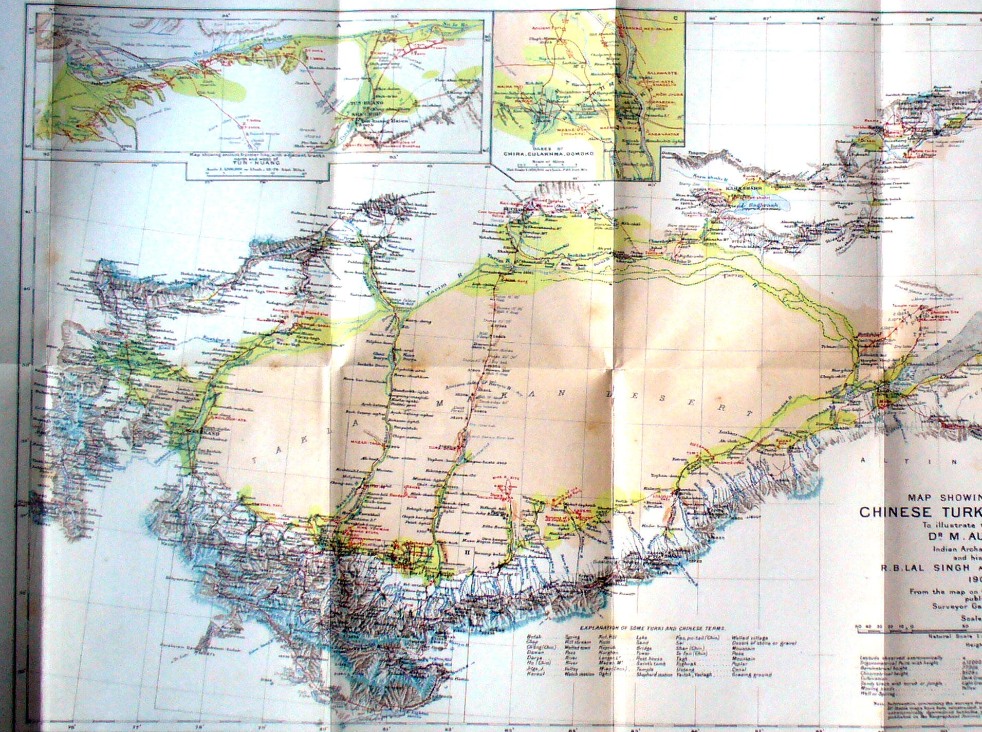
A larger view of the western side of the map of Chinese Turkestan and Kansu - The red lines showing Stein's routes are more clear - on the far left we see his route north through NW India and through the Wakhan Valley and Sarikol to Kashgar. To the north west is his route into the mountains and back. Then his route south-east to Yokand and thhen south-east to Khotan. We will look at more detailed maps to see the locations he visited around Khotan and his attempt to go directly south. Due north of Khotan is Stein's route from there to Ansi and the fort at Mazar-tagh is seen. From Khotan Stein traveled east to revisit Niya and Endere and Keriya. From Keriya due north the red line shows Stein's route coming south looking for the end of the Keriya River. To the east is Stein's route from Endere to Charchan and then Miran and Lou-lan. In the upper north-east corner is his route back from An-hsi to Hami and Khara-shahr. In the north center is his visit to Kucha. Insets above show the area around Tun-huang and Domoko. |
||