
|
 |
||
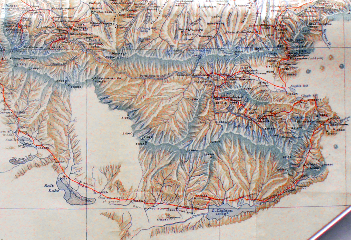
The south central section of Stein's map showing his routes through the highest mountains. Lake Lightan appears. His route begins at the far right upper corner near the Keriya River as he bypassed the front ranges from the east. One sees he moved south, then west, then south, then east to the sources of the Keriya River and south again and finally west and north-west. He found the sources of the Yurung-kash River, one of his main objectives . Note in the upper left corner the two red lines that indicate his efforts to reach the sources directly south from Khotan which were blocked 2 years earlier when the local laborers refused to continue south to the Chumaha valley. (See photos). |
||