
|
 |
||
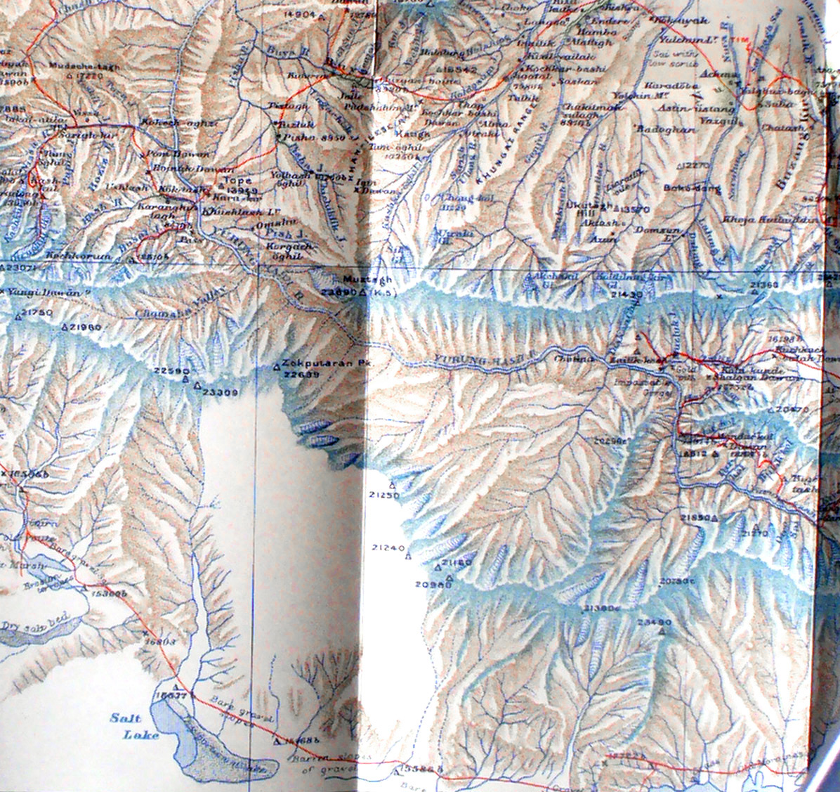
Detail from Stein's map showing the K'un-lun mountains south of Khotan - at the south side is the red line showing Stein's travel from east to west at the end of the second expedition. But what I want to show in this detail is the red lines showing his attempt to penetrate the mountains from the north seeking the sources of the Yurung-kash. See near Karanghu-tagh where the mountain men refused further work there are two red lines into the gorges. Both were blocked. Then there is the red line going north east - that is the route R. B. Lal Singh took to survey mountains east of Khotan. Above the Yurung-kash river is the massive peak Mustagh. The red line on the east center border shows Stein's route from the east during which he did find the sources of the Yurung-kash far to the east of where it leaves the mountains at Khotan. Note that since he did not physically trace the center part of the river he shows that with dotted lines. |
||