
|
 |
||
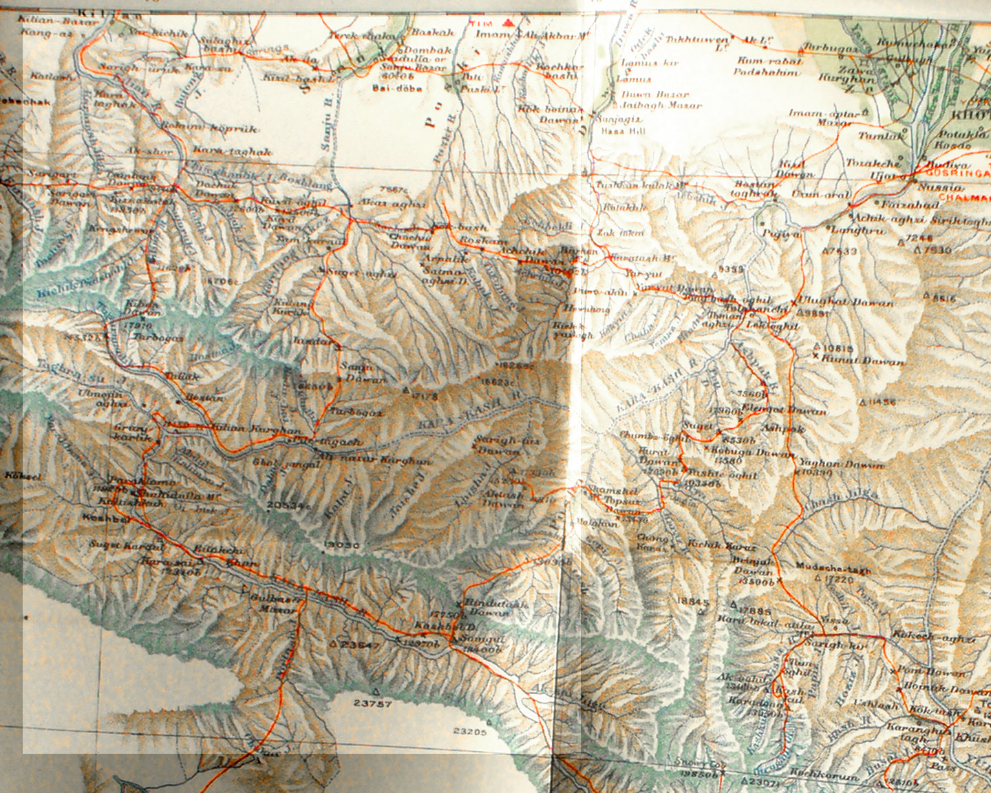
Detail from Stein's map of the K'un-lun southwest of Khotan. On the east side the red lines show Stein's unsuccessful effort to reach the source of the Yurung-kash at Karangu-tagh, the Busal valley and Ocrughul glacier. From there it shows his route back through the Chash valley and along the ridge to the Uguhal pass above the Kara-kash river. Note how the Kara-kash river flows northwest behind a crest in the K'un-lun and then makes a sharp U turn near Kilian Kurghan and flows back east and then north to reach Khotan near where the Yurung-kash passes the city. Along the west side of the map the red line traces the caravan route from Yarkand to the Karakorum Pass. |
||