
|
 |
||
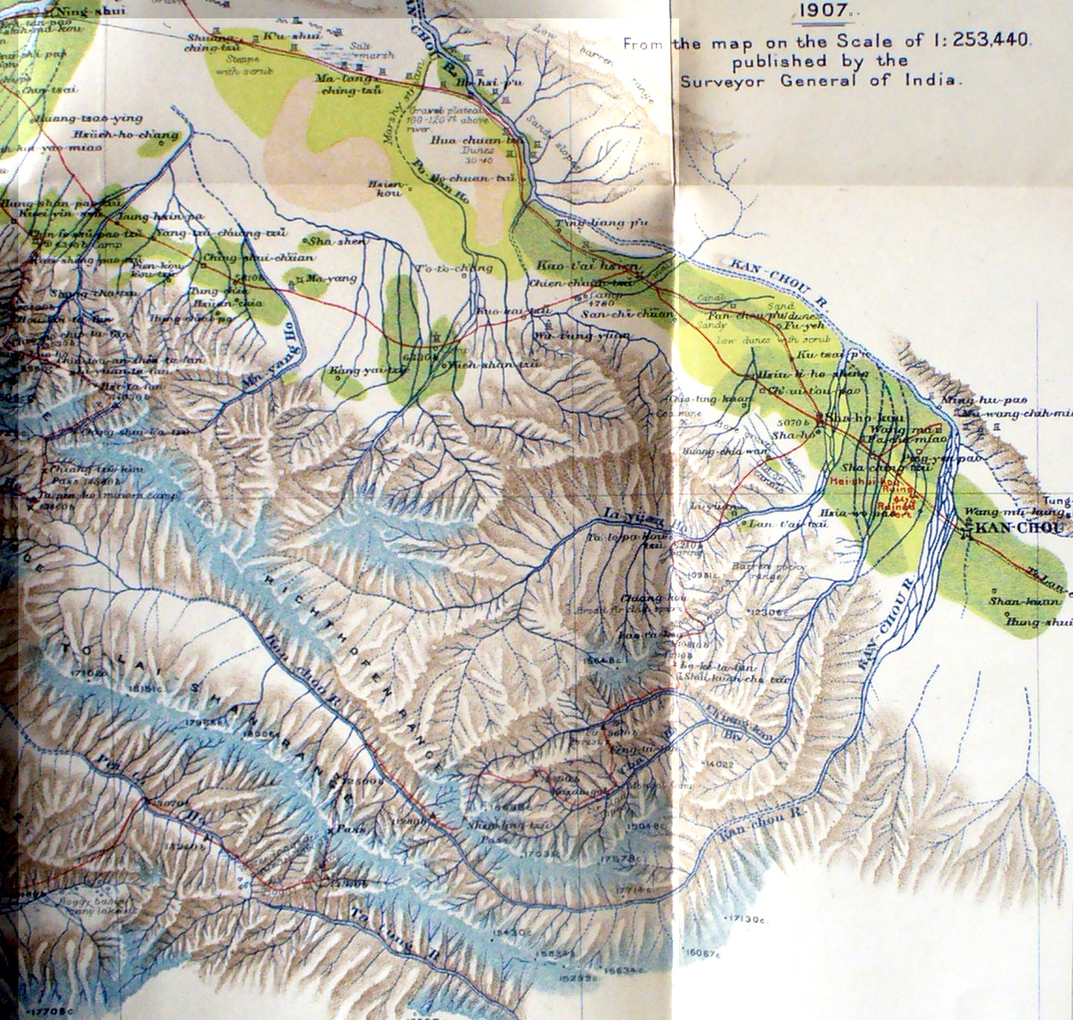
Detail of Stein's map showing Kan-chou city and the mountain ranges to the west. It shows how the Kanchou River flows south-east out of the mountains, then turns sharply north to flow into the Yellow River and the Pacific. From Kan-chou he returned along the caravan route next to the river to Su-chou - note the numerous watch towers and small forts along this route. Note at the center bottom of the map where Stein could not continue down the Kan-chou river valley through gorges but had to turn north-east and cross several ridges and passes |
||