
|
 |
||
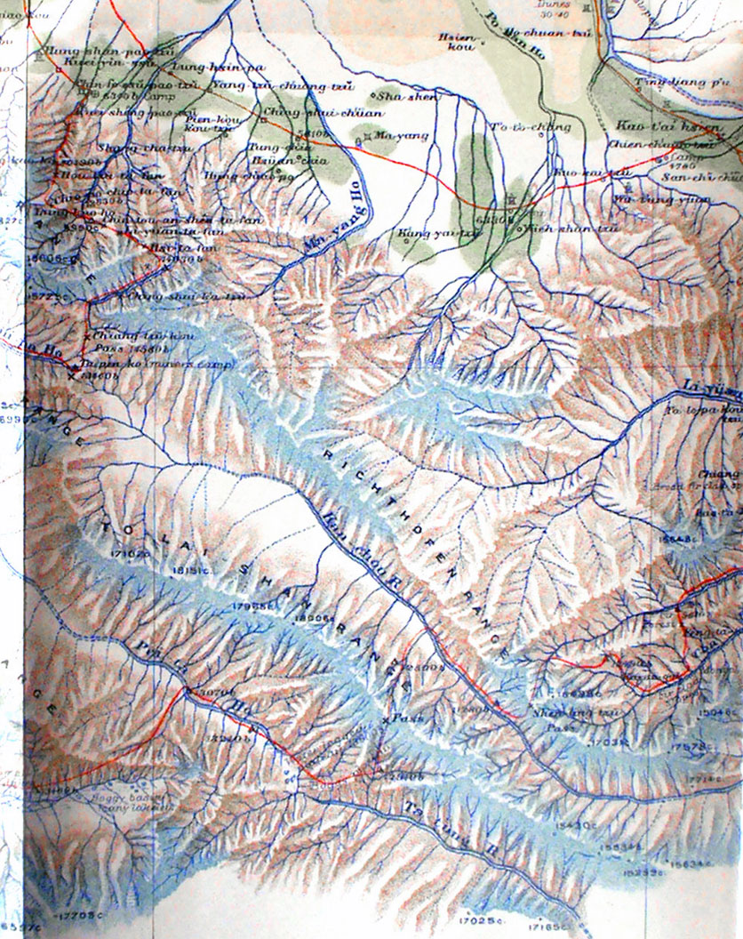
Detail of Stein's map showing his routes through the Alexander III Range, To Lai Shan Range and Richthofen Range searching for the Pei-ta Ho that flows north-west and the Kan-chou River that flows south-east. He was proud of having found the continental divide between drainage to the Tarim and the Pacific Ocean. The northern map edge shows how steep is the elevation between the mountains and the Gansu corridor. |
||