| |
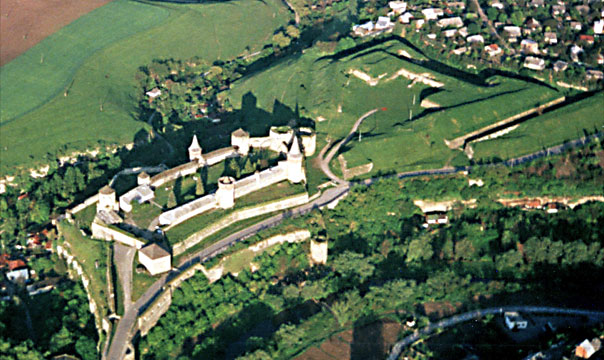
This is an enlargement of photo 3. Here we see
the castle and the 17th century outer bastion trace. The castle blocked the
only land route into the city. The city gate was on the other side of the
causeway bridge at the bottom, off picture. The river is so far down in its bed
between the double row of trees arcing from lower right side of the picture to
bottom center, that one would not know there was a large stream there without
having seen it. The entrance to the castle now has been made into the wall next
to the water tower. In that square tower is an extremely deep well. Water is
brought up by means of a bucket attached to a large treadmill operated by
prisoners or a horse. (see photo)
|
|