| |
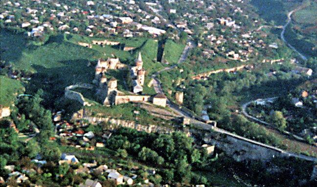
Here we have an enlargement of photo 4,
perhaps too much as it is becoming fuzzy, but we wanted to show more detail of
the castle from this side. Also here we see the interior of the 17th century
bastion trace that was built west of it to cover the approaches. The white wall
forming a fishook to the left of the castle outlines a platform for artillery
that was built during that modernization. Dirctly below are the red roofs of
the medieval caravanasairy area where merchants came from as far as Central
Asia and the Black Sea to exchange good with merchants from Central Europe.
Here the Smotrich river is flowing toward us on the right side of the castle
and away from us on the left as it bends to pass out of the photo in the lower
left corner. Please note also how high is the Turkish bridge causway that
carries the narrow road between castle and town.
|
|